Flood-Risk Data Analysis Firms Step Up as Waters Rise on Eastern Seaboard
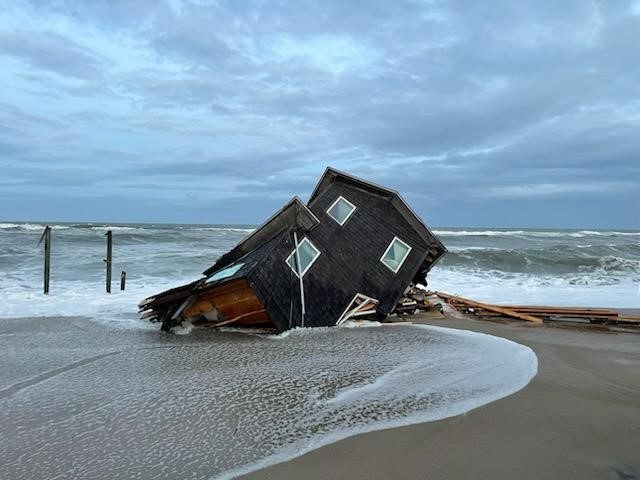
As the Atlantic Ocean continues to devour pricey beachfront properties in Rodanthe, N.C., and flooding intensifies across the U.S.—in coastal, riparian and even urban areas—an emerging ecosystem of firms is stepping in to bridge knowledge gaps that the federal government has been unable to fill.
Raleigh, N.C.-based Natrx is currently working with the North Carolina Coastal Federation to develop an analysis of the shoreline along the state’s entire coast. Using a combination of artificial intelligence and remote-sensing technologies, the effort will study ecological changes of both wetlands and shorelines along 4,000 miles of coastline.
Meanwhile, global water and climate risk intelligence firm Fathom is providing flood risk data to the Virginia Dept. of Conservation and Recreation as part of the state’s efforts to develop a flood protection master plan, expected to be completed by the end of 2025. Fathom is a unit of Zurich-based reinsurer and insurer Swiss Re, which acquired the UK-based firm in 2023.
The firms say they are providing information that the Federal Emergency Management Agency has not traditionally offered under the scope of existing statutory frameworks. FEMA does not typically evaluate risks associated with flash flooding, and mapping associated with fluvial flooding from rivers and inland bodies of water is more limited, particularly in rural areas, according to several sources.
However, FEMA maps go through a rigorous public review process, notes Meg Galloway, senior policy advisor for the Association of State Floodplain Managers. The data provided by different vendors can be useful when used appropriately, but they each have their own strengths, and limitations as well, she says, adding that because FEMA maps undergo a public process, “they’re legally defensible.”
FEMA performs base-level engineering to determine where to concentrate its efforts, and usually it’s in the locations that are at the highest risk, Galloway told ENR.
How to Map a Coastline
Jacob Boyd, salt marsh program director for the N.C. Coastal Federation, notes that North Carolina has never had maps with the type of data Natrx is collecting. The goal, he says, is to “have the insight needed to direct resources where they will have the greatest impact.”
Natrx Chief Operating Officer Tad Schwendler adds that with finite resources, having accurate data will help decision-makers focus on funding projects most critical to protecting human safety and health. “These kinds of issues are acute, and North Carolina is a good example. But this is happening throughout the country, throughout the world, and we believe that more of this kind of work, this resilience and restoration work, needs to happen,” Schwendler told ENR.
The North Carolina team will use a combination of multispectral and remote-sensing data, which will include Sentinel L2A satellite data, NAIP aerial imagery, and LiDAR from NOAA’s Digital Coast program. “These sources allow us to quantify erosion, analyze wetlands change, and model carbon distribution with a high degree of precision across large scale areas like all of eastern North Carolina,” Schwendler said.
The North Carolina analysis is part of a larger effort funded by the U.S. Environmental Protection Agency and being led by the Atlantic Conservation Coalition, which includes state governments in Maryland, North Carolina, South Carolina, and Virginia, in addition to the Nature Conservancy, Coastal Federation, and eighteen additional organizations.
Planning for the Future
In June, Fathom was awarded a contract to provide statewide current and future pluvial, fluvial and coastal flooding data to the Virginia Dept. of Conservation and Recreation to inform a flood protection master plan in collaboration with Arcadis. According to the Commonwealth of Virginia’s latest hazard mitigation plan, the state anticipates approximately $13 million in flood damage per year in flood-related events.
John Millspaugh, project manager at Arcadis, said in a statement: “Consistent data across localities is essential for developing a meaningful statewide plan that addresses data gaps and enables comparison across regions.”
Gavin Lewis, head of engineering at Fathom, said in an interview with ENR that the firm—which boasts that it has already mapped much of the country’s watersheds and coastlines—seeks to complement what FEMA is already doing. “There’s a lot of good FEMA data out there, but there’s a significant proportion that is …15 to 20 years old,” Lewis said. “We’re able to provide that contemporary view of flood risk for people to analyze and get a much clearer understanding at a the scale they need for the impact of flooding” whether it’s for their communities or assets.
The post "Flood-Risk Data Analysis Firms Step Up as Waters Rise on Eastern Seaboard" appeared first on Consulting-Specifying Engineer